.png)

June in Breckenridge, Colorado, offers a unique blend of lively events, stunning mountain scenery, and a welcoming community spirit. This month marks the start of exciting events, outdoor markets, and athletic challenges that bring Summit County to life. Choosing to stay at the Wedgewood Lodge enhances your experience with comfort and convenience, placing you close to the heart of the action on Main Street. Here's why June is the perfect time to visit Breckenridge and why the Wedgewood Lodge should be your home base.

Celebrate Breck Pride
(Thursday, June 11th - Saturday, June 13th)
Breck Pride is a vibrant celebration of the LGBTQIA+ community and Breckenridge's first annual event of the summer. This event will feature live music, drag performances, carnival-style games, art experiences, an outdoor market, group outdoor activities, and a Pride March down Main Street Breckenridge. Everyone is welcome to attend, support equality, and celebrate our incredibly diverse and amazing mountain community!
This free event will be spread out around downtown Main Street. All event activities are within quick walking distance from Wedgewood Lodge, allowing guests to enjoy the festivities without worrying about transportation and parking. Book with us and use code PRIDE between 6/11 and 6/13 to get 18 - 30% off!
This event is the perfect way to get the summer started. Our team is excited to share in the spirit of inclusion and celebrate. We can't wait to see everyone's incredible outfits!
Click here to learn more about the event and view the action-packed weekend schedule!

Click here to book your stay at the Wedgewood Lodge!


Experience the Breckenridge Agave Festival
(Friday, June 26th - Sunday, June 28th)
This event is a must for lovers of tequila, tacos, mezcal, and margaritas. The festival offers live music, tastings, and food pairings that highlight the rich flavors of agave spirits. Meet expert mixologists, distillers, and local chefs as they team up to celebrate Mexican cuisine and culture. Join the fun and vote to see who wins best margarita!
Staying at the Wedgewood Lodge puts you just three blocks from the heart of the Breckenridge Agave Festival, making it the perfect place to call home for the weekend. After a day of sampling premium spirits, you can retreat to the comfort of your unit or make the most of our incredible outdoor hot tubs and fire pit.
Our team is looking forward to the incredible food, energy, and amazing outdoor venue. Spread out between The Village Plaza and Main Street Station; this annual celebration is something you won't want to miss!
Click here to learn more about the event, explore package pricing, and purchase tickets!


Trail Running and Mountain Biking with RaceBreck
June is the perfect time to participate in one of the local race series. Offered in partner with the Town of Breckenridge Recreation Department, these events attract runners and cyclists from across Colorado and beyond. These races take advantage of the stunning mountain terrain and well-maintained trails around Summit County.
Whether you want to participate or cheer on the athletes, the energy is contagious. Stay at the Wedgewood Lodge to make accessing events a breeze. Bring your bike and take advantage of our newly built, secure indoor bike storage. Our outdoor hot tubs are the perfect place to relax sore muscles and catch the sunset after a long day.

Click here to learn more about RaceBreck trail running events and register!
Click here to learn more about RaceBreck mountain biking events and register!


Other Exciting Reasons to Visit Breckenridge in June
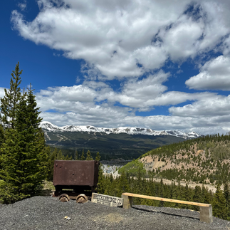
Beyond the headline events, June in Breckenridge offers plenty of reasons to explore. The weather is ideal for hiking, fishing, golfing, mountain biking, water sports, horseback riding, and mine explorations. Wildflowers are starting to bloom and wildlife becomes more active. Cultural events, art shows, and live music performances provide entertainment options for all tastes. The friendly atmosphere and scenic beauty make Breckenridge a great destination for families, couples, and solo travelers alike.
For those who enjoy a laid-back pace, the Sunday Markets start June 7th. The venue appears every Sunday from 10am - 3pm until September. These markets showcase local artisans, handmade goods, and fresh produce. Wandering through the market at Main Street Station allows folks to connect with the community and uncover unique souvenirs.
The Breckenridge Farmers Market begins Thursday, June 18th from 4:00pm - 7:00pm. This recurring afternoon event will fall on a Thursday every week until the end of September. Stop by to get local produce, meet vendors, and explore new flavors.
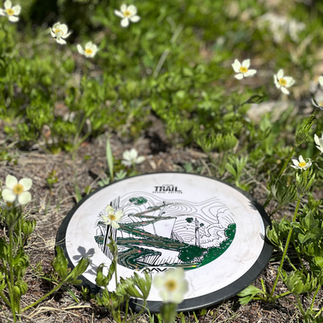
Book a tee time at the Breckenridge Golf course or check out the Frisco Adventure Park for free disc golf. Horseback riding is available at the Breckenridge Stables. Make sure to go online and reserve in advance for big ticket activities you won't want to miss!
Water based activities such as paddle boarding, kayaking, boating, white-water rafting, and fly fishing are huge hits throughout Summit County. The water may be cold, but when the temperatures are hot, it's the best combination!
Bring your own watercraft or rent locally! Check out the Frisco Marina or Dillion Marina to rent non-motorized water vessels. For motorized rentals, such as pontoon boats, you'll want to visit the Dillion Marina. Water levels will be too low to launch motorized vessels from Frisco Marina in 2026.
Check out the Breckenridge Farmers Market or the Sunday Market!
Check out Guiding White Water Raft Trips and Zipline Tours!

Book a Mine Tour and Gold Pan!

Why You Should Stay at the Wedgewood Lodge
If you plan on visiting Breckenridge this summer, staying at the Wedgewood Lodge is an obvious decision. The lodge offers a perfect blend of comfort and convenience. Guests can enjoy easy access to a plethora of outdoor activities, all while being just minutes away from the charming downtown area. With its welcoming atmosphere and prime location, the Wedgewood Lodge ensures a memorable summer getaway for all visitors.
The Wedgewood Lodge features spacious accommodations with fully equipped kitchens, making it ideal for families or groups looking to unwind after a day of adventure. Chat with our front desk employees to get local recommendations, tips, and insights on the best places to eat, explore, and enjoy during your stay.
In addition to the inviting atmosphere, take advantage of our incredible amenities. We offer complimentary Wi-Fi and parking, ensuring a hassle-free stay with no hidden fees. Experience the ultimate relaxation as you soak in our outdoor hot tubs and gather around the fire pit to watch the sun set. Guests also have access to an off-site outdoor pool and hot tubs at the Upper Village Pool.
For those who love biking, our bike room includes a repair station, making it convenient for cyclists to maintain their gear. Recently renovated, the entire lodge boasts a fresh and clean aesthetic, providing not only the best choice for your stay but also a welcoming and cozy environment. With its incredible location and exceptional amenities, the Wedgewood Lodge is the perfect destination for your next getaway.